Borders, Immigration, and reality ...
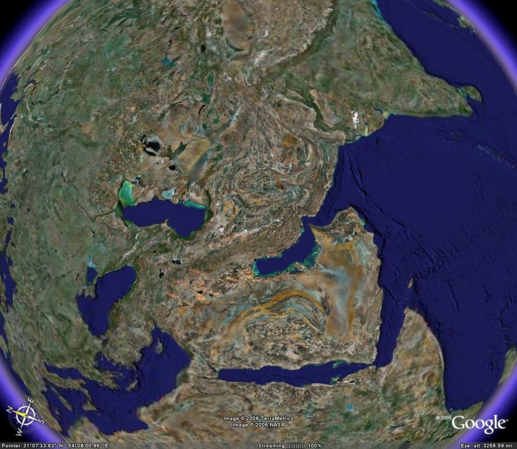
On the image above are Bagdhad and Riyadh, Cairo and Tel Aviv. Jesus walked roads in that image, as did his forefathers Moses and Abraham and Noah, and his successor Muhammed. In the upper right, Prince Siddartha walked the path to becoming the Buddha, and Hindu Vedas have been sung for millenia. Cities like Bagdhad are so ancient, they go by multiple names ... does the war in Iraq look any different if we talk about shelling and street fighting in Babylon?
We all know these names, these places ... they resonate with power and vision in our minds, even if we don't agree with the notions. And yet, how many of us can look at the above picture and tell me where the manger in Bethlehem was that Jesus was born in, or where the cities of Soddom and Gommorah were punished by God so many millenia ago? How many of us could point to where Prince Siddartha walked, or to the desert Moses and his people wandered for 40 years in? Can we draw the borders of the very states we are at war over today even? How many of us can find ancient Babylon, even as so many of our friends and daughters are fighting there?
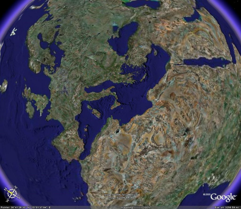
Charlemagne road to victory above, and so did Joan d'Arc. Norse barbarians became Normans, and more Norse barbarians attacked again. Ancient Celts built massive stone circles, and Empires from Rome through Athens rose and fell long before anyone ever heard the names London or Munich.
But again, without the convinient lines and dots, do we know where half a dozen Popes wages war against aggressive Muslim warlords for 2 centuries? Can we point to the battlefield at Hastings, or even the beaches of D-Day? How many of us could accurately draw the borders that the world fought so bloodily to preserve half a century ago? How many of us see the irony of the fact that those borders, in many cases, no longer exist?

This is, ofc, home for me ... Good old North America. Ancient Mayans built some of the largest cities in the world here, and Incans developed amazingly complex systems of writing with knots and ropes in distant South America. Spanish colonists/Conquistadors marched into the largest city on earth in one of the largest mass colonizations in history even while the Aztecs being colonized were sacrificing their own populace.
But I am hard pressed to even point at my city accurately, the pace I was born. I get it "about right" and I can generally find the outlines of the province I have spent 80% of my life in, but the whole thing is VERY general. Its certainly not obvious by looking at the picture where, for example, my country should be divided from the USA, and and the border lines between my own province and the neighbouring ones should be ... they truly are arbitrary lines on a map.
The space age has done one important thing for humans ... its shown us what our planet REALLY looks like. When you take away the pretty colours for countries, and the border lines, and just look at what we look like, its almost impossible to put them back in accurately in most cases. The reason for that is simple ... the are arbitrary and meaningless.
Politics and borders are fluid, geography is not. We live on a planet that we all must share ... its the only one we have. Look at the pictures ... we live on a beautiful planet ... but there are no lines on the real thing. Thats a good thing, and should be celebrated.
posted by Elron @ 11:20 a.m.
1 comments
![]()
![]()


1 Comments:
despite the massive populations in many of the countries, the other
thing that you cant see on these maps are people themselves....the
scourge of the planet.
Post a Comment
<< Home